In shortA bayou is a waterway. The National Park Service defines bayous as slow-moving marshy waterways, the constantly flowing, typically wide and shallow parts of rivers, streams and coastal estuaries, with water that can be fresh, brackish or salt. A swamp is a wetland dominated by woody plants, cypress among them in south Louisiana. A marsh is inundated ground dominated by soft-stemmed plants such as reeds and cordgrass.
about 26,000 acresbayous, swamps, marshes, forests
3plant systems at Barataria
2,006 square milescoastal land lost 1932-2016
from $765-hour swamp and bayou boat tour
What is a bayou in Louisiana
Start with the water itself. In Park Service terms a bayou is the slow-moving, marshy stretch of a river, stream or coastal estuary, usually wide, usually shallow, and always in motion. The word comes from the Choctaw Bayuk, meaning small stream. That original sense is closer to what you see from the deck than the postcard version most visitors arrive with.
Bayou water can be fresh, brackish or salt, and that single fact explains why one bayou runs dark under a closed roof of trees while another lies in open grass with the coast pushing into it. Flow is the test the Park Service applies: bayous are described as constantly flowing, whereas a swamp fed by surface water or groundwater may be stagnant or flowing. The same word covers an inland stream and part of a coastal estuary.
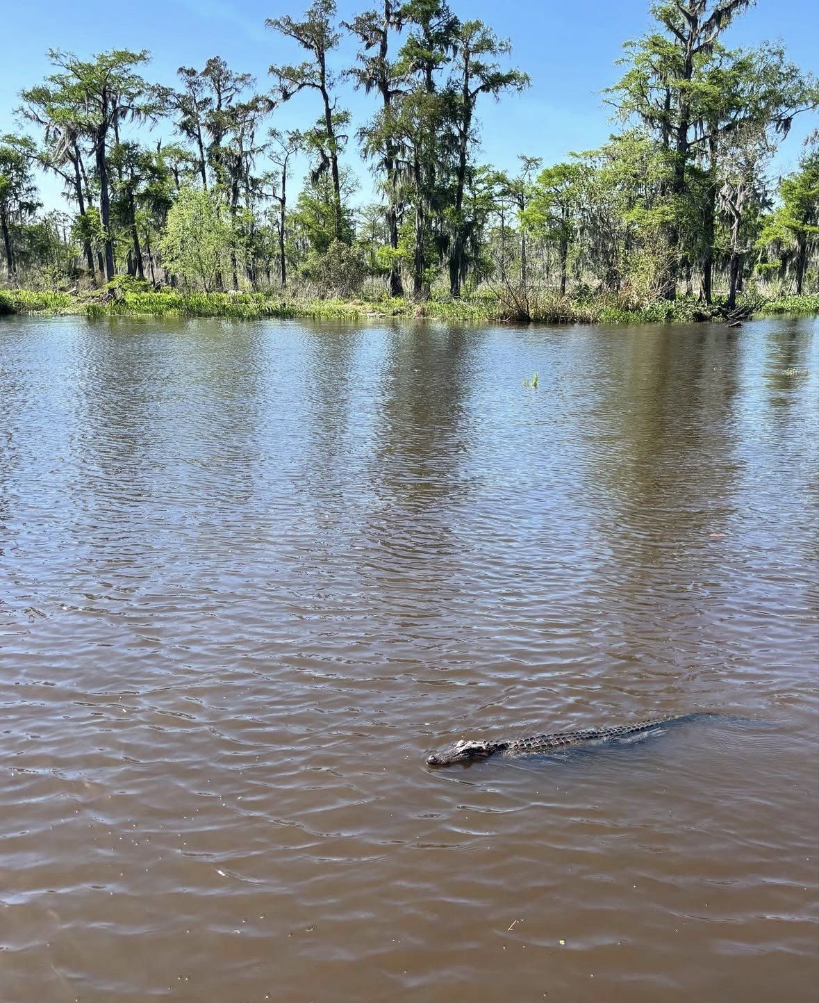
The channel is the thing your boat actually follows, and within half an hour it can run through forest, out into open grass, or along the edge where the two meet.
The difference between a swamp and a bayou, and where the marsh fits
The bayou is the water you travel on, and the swamp is the flooded forest standing around it. The EPA defines a swamp as a wetland dominated by woody plants, split into forested and shrub types, and lists cypress (Taxodium spp.), red maple, overcup oak and willows among southern forested swamps. Woody plants in standing water is the whole of the definition, so a shrub thicket qualifies just as a cypress stand does.
A marsh has no canopy. Under the same classification it is frequently or continually inundated and dominated by emergent, soft-stemmed vegetation: cattails, reeds, bulrushes, and smooth cordgrass (Spartina alterniflora) in saline tidal zones.
Barataria Preserve is organised into three plant systems: hardwood forest, swamp and freshwater marsh, the marsh a complex of reeds, sedges, grasses and shrubs. From a boat seat that is roughly the order the scenery arrives in, trees first, then shrubs, then grass to the horizon.
| Wetland type | What defines it | Typical plants | The water |
|---|
| Bayou | Slow-moving marshy waterway, constantly flowing | Marshy edges; trees where the channel runs through swamp | Fresh, brackish or salt |
|---|
| Swamp | Wetland dominated by woody plants, forested or shrub | Cypress (Taxodium spp.), red maple, overcup oak, willows | Forested swamps often flooded by nearby rivers under many feet of slow-moving or standing water |
|---|
| Marsh | Frequently or continually inundated, soft-stemmed emergent plants | Cattails, reeds, bulrushes; smooth cordgrass in saline tidal zones | Non-tidal marsh depths usually a few inches to two or three feet |
|---|
Short covered boat ride from Marrero
With a car and only a morning free, this covered swamp boat from 9706 Barataria Blvd in Marrero puts bayou water under you and swamp trees on both sides in 1 hour 40 minutes, from $35, rated 4.9 ★ (2348 reviews). The boats push off on time, so build in the 20 minutes the operator asks for before departure.
★ 4.9/5 · 2,348 reviews
Cypress, tupelo and the grey stuff hanging in the branches
Cypress-tupelo swamp is the phrase the state's coastal authority uses for the Maurepas basin, and it fits the forested wetlands north and south of the city. Cypress gives you the buttressed trunks and the knees breaking the surface. Tupelo stands in the same water with a smoother, straighter stem.
The Park Service classes Spanish moss as an epiphyte rather than a parasite: it collects moisture and nutrients from the air and does no damage to branches unless it grows so dense and heavy that the weight itself becomes the problem. It is more closely related to pineapples and other bromeliads than to any moss, so the grey strands draped over a cypress limb are taking nothing from the tree.
History explains the shape of some stands better than biology does. Cypress logging at its peak took the whole land bridge between Lakes Pontchartrain and Maurepas, clear cut in the late 1800s and early 1900s, so the trees framing the channel today are second growth rather than original forest.
Young cypress has a harder time than old cypress. Saltwater turns out not to be the culprit: the Wetlands Restoration Laboratory at Southeastern Louisiana University found bald cypress remarkably tolerant of short-term saltwater of about two weeks, and turned up no evidence linking saltwater intrusion to the missing young trees in Manchac and Maurepas. Nutria account for much of it: released from a south Louisiana fur ranch in the 1920s, they chew young seedlings at the base and cause 100% mortality of unprotected seedlings in the Manchac swamp.
How deep the water is and how much wetland sits next to the city
Depth is one of the cleaner ways to tell the systems apart. Forested swamps are often flooded by nearby rivers under many feet of slow-moving or standing water, while non-tidal marsh usually holds a few inches to two or three feet. In tidal wetlands the lower marsh is covered and exposed daily by the tide and the high marsh only sporadically, so the same patch of cordgrass can look like open water in the morning and like a lawn by mid-afternoon.
The scale close to the city is easy to underestimate. The park's Nature page credits Barataria Preserve with more than 23,000 acres of swamp, marsh, trails and waterways, while the preserve's own page gives the unit as about 26,000 acres of bayous, swamps, marshes and forests. The address is 6588 Barataria Blvd, Marrero, LA 70072, and New Orleans & Company puts it just 30 minutes outside the French Quarter.
Seeing those three systems on foot is limited for now. Hurricane Ida repair work shut the Barataria Preserve Visitor Center and most of the trail network on 2 February 2026, a job the Park Service puts at about two years, and the boardwalk run from Bayou Coquille to Marsh Overlook is part of what is behind the barriers. That leaves the water as the place where the vocabulary comes together this season and next. Check current conditions on the day you plan to go.
Why the map keeps changing
The outlines on any wetland map are provisional: between 1932 and 2016 coastal Louisiana gave up roughly 2,006 square miles (5,197 km2) of land, a figure carrying a margin of error of plus or minus 171 square miles. USGS puts the peak loss rate at about 32.0 square miles a year and the most recent moderate rate at about 10.8 square miles a year, which it translates as a football field of wetlands every 34 minutes at the fastest and every 100 minutes more recently.
Salinity is part of the story. Construction of the Mississippi River-Gulf Outlet raised salinity in Lakes Pontchartrain and Maurepas, and the Pontchartrain Conservancy records that surface and soil salinity have decreased since the closure, with smaller fluctuations.
Work is under way to push fresh water back in. The River Reintroduction into Maurepas Swamp will send Mississippi River water through a 5.5-mile controlled-flow diversion into the cypress-tupelo swamp, adding nutrients, flushing out stagnant low-oxygen water, delivering fine sediment and freshening the swamp if salinity reaches levels that harm the trees. The first construction started at Hope Canal in 2024, a second stretch near Garyville follows in 2027, and the estimate for finishing the whole diversion is 2030.
- Bayou: a channel, constantly flowing, fresh to salt
- Swamp: woody plants in standing or slow water, cypress and tupelo here
- Marsh: no canopy, soft-stemmed plants, shallower water, daily tidal change in the lower marsh
- Spanish moss: an epiphyte living on air, closer to a pineapple than to moss
Questions people ask
Is bayou water fresh or salty?
Either, and sometimes in between. The Park Service states plainly that bayou water can be salt, fresh or brackish, because a bayou may be part of an inland stream or part of a coastal estuary. That is why the plant life along two bayous an hour apart can look nothing alike.
Is every swamp near New Orleans a cypress swamp?
Cypress is the signature tree, though the category is wider. The EPA splits swamps into forested and shrub types and names red maple, overcup oak and willows alongside cypress (Taxodium spp.) in southern forested swamps. Barataria Preserve also holds hardwood forest as a plant system separate from its swamp and its freshwater marsh.
Which of the three will I actually see on a boat tour?
Most routes out of the Barataria basin follow bayou channels through swamp forest and reach the edge of freshwater marsh, since all three systems sit inside the same preserve. Longer trips give you more time in each. If you want the marsh rather than only the tree corridor, say so when you check the itinerary.
When is the most comfortable month to be out on this water?
October and November sit mildest for this kind of trip: highs average in the 60s°F, lows fall to the 40s and 50s°F, and the rain comes less often. The stretch to avoid for a long slot on open water is June to September, when highs often sit in the low 90s°F and the heat index can climb to 110°F. Hurricane season spans June through November, so leave a spare day in the plan.
Do I need a car to see both a bayou and a swamp?
No. The docks sit outside the city, but several tours on this site include transport from downtown, among them the 5-hour Swamp and Bayou Boat Tour with Transportation, from $76, and the Small-Group Manchac Swamp Kayak Tour, 2.5 hours from $90, which includes transportation from the French Quarter, a paddle lesson and all gear.
Read also